We are open by appointment and every 3rd Friday from 7 - 10 pm. Contact us to schedule your visit!

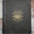
1878 Illustrated Historical Atlas of Wisconsin
Load image into Gallery viewer, 1878 Illustrated Historical Atlas of Wisconsin

1878 Illustrated Historical Atlas of Wisconsin

Regular price SOLD

 More payment options

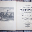
Historical atlas of Wisconsin embracing complete state and county maps city and village plats, together with separate state and county histories, also special articles on the geology, education, agriculture, and other important interests of the state, illustrated

By: Snyder Van Vechten & Co.

Date: 1878 (dated) Milwaukee, WI

Dimensions: 18 x 15.25 inches (45.75 x 38.75 cm)

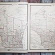
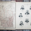
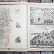
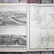
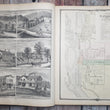
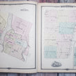
This is a pristine example of Snyder Van Vechten's Historical Atlas of Wisconsin, published out of Milwaukee in 1878. The atlas consists of over 320 pages and 180 hand colored maps, including that of the hemispheres, country, state of Wisconsin, counties, cities and towns. In addition, there are over 70 illustrations of schools, homes, farms, businesses, hospitals, government buildings and other establishments as well as portraits of governors and other people of importance.

Published thirty years after receiving its statehood in 1848, Wisconsin was undergoing decades of economic growth, especially after the Civil War during the Guilded Age of America. Its economy was primarily supported by agriculture, logging, and brewing, the latter receiving and influx of new breweries as a result of the Chicago Fire of 1871. All of these industries are represented in the atlas through the many lithograph views and prints that accompany the maps.

Nearly half of the atlas is devoted to text covering the history of Wisconsin beginning with the early tribes of the Sioux and Algonquin that inhabited the land, followed by the history of Wisconsin as a territory and then a state. This is followed by articles on special subjects that include geology, climate, flora and fauna, mineral resources, and railroads, to name a few. Each county also has a section dedicated to its history and other pertinent information. The atlas concludes with statistical tables by county, patrons of Wisconsin detailing their occupation and place of birth, and lastly, a business directory featuring many of the same patrons.

Condition: This atlas is in excellent condition with no imperfections aside from some rub and scuffs to the cover boards. The leather spine is entirely original and intact with all pages securely bound. Overall, this atlas could not be in much better shape unless it was printed yesterday.  

Inventory #12261

1200 W. 35th Street #425 Chicago, IL 60609 | P: (312) 496 - 3622

Close (esc)

Join Our Newsletter

Interested in maps, prints, and upcoming related events? Sign up for our newsletter for fresh NWC inventory and announcements.

Age verification

By clicking enter you are verifying that you are old enough to consume alcohol.

Search

Shopping Cart

Your cart is currently empty.
Shop now