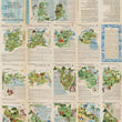

1953 Sketch Map of Italy with the Lines of Communication by Road, Rail, Sea and Air
DESCRIPTION
This vintage folding map of Italy focuses on the various modes of transportation available in the mid-twentieth century. As indicated by the title, the map depicts roads, railways, steamship and other means of seagoing vessels and air routes, all clearly indicated and outlined in the legend at the left. Images of seagoing vessels and aircraft are shown along the myriad routes. Cities, towns, villages and historical landmarks are noted and named, and distances between cities are denoted.
An inset in the upper right depicts Rome and its environs in some detail. The verso includes pictorial drawings of Italy’s regions accompanied by English text describing each area’s places of interest. The brochure was published by ENIT, the Italian State Tourist Office and reprinted by Roberto de Gasperis.
CONDITION
1200 W. 35th Street #425 Chicago, IL 60609 | P: (312) 496 - 3622


