
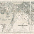
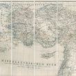
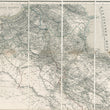
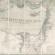
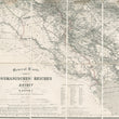
1869 General Karte des Osmanischen Reiches in Asien
DESCRIPTION
This large scale folding map depicts the extent of the Ottoman Empire in its later stages, just a few decades preceding its collapse and the founding of the Republic of Turkey with Kemal Mustafa Ataturk at its head.
The territories depicted in the map start in Thrace, in southeastern Bulgaria, which is still part of modern-day Turkey, includes the Aegean and its islands, and on the southern shores of the Mediterranean Sea, portions of Libya and Egypt in Africa are depicted. The map’s northern borders include the Black Sea, Georgia and Azerbaijan. A portion of the Caspian Sea is also included in the upper right.
Farther south, Anatolia, Lebanon, Syria, Israel, Jordan, Iraq, a portion of Iran and Saudi Arabia are all delineated. The northern half of Egypt is shown in some detail, especially at the estuary of the Nile. The northerly portions of both the Persian Gulf and the Red Sea are included.
The map is highly detailed with relief shown in hachure, with original outline colouring. A detailed legend is featured in the lower centre of the map providing colour coded identification of cities, villages and provinces, and a table in the lower right provides German equivalents for Persian and Arabic terminology.
Published in Berlin, the map is written primarily in German. The map comes in folding pocket-book form with original fabric cover on which was pasted the name of the map in English, Osmanian Empire in Asia. The map was sold through the well-known London map seller, Edward Stanford, located at 55 Charing Cross Road.
CONDITION
1200 W. 35th Street #425 Chicago, IL 60609 | P: (312) 496 - 3622


