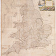


1794 A New Map of England & Wales...
A New Map of England & Wales Drawn from several Surveys &c. On the New Projection; Corrected from Astronomical Observations & the Places marked where thh Observatns. were made By Thos. Kitchin Geogr. The Canals inserted to 1792 by J. Phillips, Surveyor
By: Robert Laurie & James Whittle
Date: 1794 (dated) London
Dimensions: 51 x 42.5 inches (129.5 x 108 cm)
This is an impressive, large map of England and Wales, printed on four sheets that have been joined through linen-backing. The map is rich with geographic detail and pays special attention to the intricate system of Canals that drove transportation and industry in England and Wales prior to the implementation of railroads in the mid-19th century. Along the coastline we find text boxes the provide extra insight into navigable and surveyed canals. Additionally, a table titled The Inland Navigations in England &c. provides length and elevation changes of over thirty canals in England and Wales.
Condition: Map is in B condition, joined and preserved through linen backing. Old chips in the paper (mostly along the lower margin) have been filled in and do not distract from the overall eye-appeal of the map.
Inventory #12623
1200 W. 35th Street #425 Chicago, IL 60609 | P: (312) 496 - 3622


