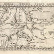

1574 Africa Minor Nuova Tavola
By: Girolamo Ruscelli
Date: 1574 (published) Venice
Dimensions: 7.25 x 10.25 inches (18.42 x 26.04 cm) plate size
This Ruscelli map from his work La Geografia di Claudio Tolomeo Alessandrino, is based on the work of Ptolemy and provides a close-up view of a portion of north central and western Africa from the city of Stora in the northwest, to Tolometa in the northeast, with Tripoli close to the center. It also extends southward to the Atlantic, to a river called Los Esteros and continues to the point at which the coast goes south, and includes a number of river systems which empty into it along the coast. The map depicts cities, river systems and lakes, mountain ranges and a large forested area.
Girolamo Ruscelli (1500-1566) was an Italian academic, polymath, humanist, scholar, editor, and cartographer active in Venice during the early 16th century. Ruscelli is best known for his important revision of Ptolemy's Geographia, published posthumously in 1574.
Condition: This map is in A condition. Heavily inked plated with a sharp clear impression. Very minor spot of foxing in the image. Italian text on the verso.
Inventory #11789
1200 W. 35th Street #425 Chicago, IL 60609 | P: (312) 496 - 3622


