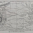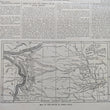


1859 Map of the Gold Region with the Routes Thereto (Pike's Peak)
DESCRIPTION
This is an intriguing map of the Colorado "Gold Region" surrounding Pike's Peak, that provides the primary routes and landmarks prospectors would encounter on their journey into the Western American Frontier. Dated April 2, 1859, this map and accompanying article is a wonderful period piece coinciding with start of 2nd great migration of gold prospectors heading west, known as the Colorado 59'ers.
The map illustrates a vast area covering the western plains and Rocky Mountain regions, with identifiable geographic features such as rivers, mountain ranges, forts, and trails leading to the gold fields near Pike's Peak. It highlights prominent points along the way, such as Fort Kearney, Fort Laramie, and several other forts and mail stations, which were vital stops and resupply points for travelers. The routes outlined in the map guide prospective miners from eastern cities through the plains and toward the mountainous regions where the gold fields were located. The labels and the intricate layout of trails and rivers emphasize the challenging nature of the journey and the significant distances prospectors needed to traverse.
How to Get to Pike's Peak Gold Mines
The accompanying article titled "How to Get to Pike's Peak Gold Mines" provides essential information and guidance for prospective gold miners heading to the region. It begins by referencing Lieutenant G. K. Warren's report on the topographical survey of the areas in Nebraska and the challenges in communication due to the remote and rugged terrain. The article notes the discovery of gold in the "Palladian" quantities, spurring interest and ambition among fortune-seekers from across the United States.
It describes the different routes and options available for reaching the gold mines, emphasizing that routes through the Cheyenne or South Pass were preferred. The article warns of the difficulties of travel, including the potential for adverse weather, harsh terrain, and the risks of interacting with Native American tribes along the way and there is mention of government efforts to manage and protect the new migration of settlers and miners, detailing the need for military escorts and support to maintain the safety of travelers.
About the Pike's Peak Gold Rush
The Pike's Peak Gold Rush, which began in earnest around 1858, was one of the many American gold rushes that ignited a mass movement of people seeking fortune. Following the earlier California Gold Rush, rumors of gold discoveries near Pike's Peak in the Colorado Territory attracted thousands of hopeful prospectors, often referred to as "Fifty-Niners," a reference to the year 1859 when the rush was at its height. Despite the rugged terrain and challenging conditions, people traveled from all over the country, creating a significant migration that would shape the development of the region.
However, many found that the riches were harder to obtain than expected, and some found the yields insufficient to support the influx of miners. The rush contributed to the early settlement and development of Colorado, leading to the establishment of Denver and other key settlements. The article and map in Harper's Weekly captured the excitement and perils of the Pike's Peak Gold Rush, providing critical information for those who were set on making the journey westward in hopes of striking it rich.
CONDITION
1200 W. 35th Street #425 Chicago, IL 60609 | P: (312) 496 - 3622


