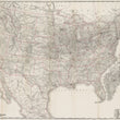
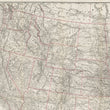
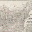
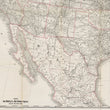
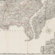
1889 New Official Railroad, State, and Territorial Map of the United States of America, Canada, and Mexico
DESCRIPTION
This large railroad map provides a comprehensive cartographic representation of the United States, its bordering regions, and neighboring countries, showcasing the extensive network of railroads that connected major cities and remote areas alike.
The map is marked with delicate, intricate lines that delineate the many railroad routes sprawling across a diverse American landscape, interwoven in a dense web that connects not only the eastern and western United States but also extends into Canada and Mexico. State and territorial boundaries are highlighted in light red, offering clarity and structure to the vast railroad infrastructure, while rivers, lakes, and mountain ranges add geographical context. Major cities are marked prominently, indicating hubs of rail connectivity during the period, and smaller towns and rural areas are connected through secondary lines, illustrating the reach of the railroad system into various parts of the country.
In the lower right corner, there is an inset map detailing the Atlantic coast states, engraved at a larger scale for enhanced visibility, highlighting the dense concentration of rail lines in this industrially active region. The map provides detailed topographic information with labels for states, regions, and even some notable landmarks, painting a vivid picture of the late 19th-century landscape of North America.
American Railroad System in the Late 19th Century
During the late 1800s, the United States was undergoing rapid industrialization and expansion, and the railroad system was at the heart of this transformation. By 1889, the American railroad network had become one of the most extensive and complex in the world. Railroads connected nearly every corner of the nation, facilitating the movement of goods, people, and resources at unprecedented speeds. Major routes linked the east and west coasts, fostering commerce and communication, while smaller lines spread throughout the Midwest, South, and the western territories, enabling the expansion of rural communities and the growth of new towns.
This era was marked by the dominance of railroads as the primary means of overland transportation, with tracks crisscrossing through populated areas, mountainous regions, and open plains alike. Rail companies competed fiercely for control over key routes, and new technological advancements in rail construction allowed for previously uncharted terrains to be accessed. The extensive network not only facilitated economic growth but also played a significant role in shaping settlement patterns and the social landscape of America during the period.
Rand McNally & Co. was founded by William H. Rand and Andrew McNally in 1856 in Chicago, Illinois, and became one of the most prominent American map publishers. Initially a printing company, Rand McNally shifted its focus towards maps and atlases in the 1870s, seizing on the growing demand for navigational aids during America’s rapid expansion and industrialization. The company's innovative use of color printing and development of the first indexed road map revolutionized map-making, setting new standards in cartographic quality and detail.
Throughout the late 19th and 20th centuries, Rand McNally established itself as a leader in geographical and travel publications, producing maps and atlases that became essential tools for travelers, businesses, and educational institutions alike. Today, Rand McNally is recognized for its historical contributions to cartography and its influence on travel and navigation across the United States.
CONDITION
1200 W. 35th Street #425 Chicago, IL 60609 | P: (312) 496 - 3622


