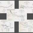
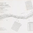
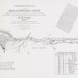
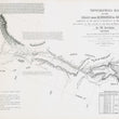
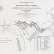
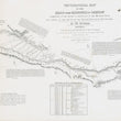
1846 Topographical Map of the Road from Missouri to Oregon... Sheets II - VI
DESCRIPTION
A scarce set of five detailed topographical maps from Captain John C. Frémont's 1843 expedition with notes that vividly chart the historic Oregon Trail, offering pioneers crucial insights into the rugged terrain, key landmarks, and Native American territories along their journey west. Originally published as a set of seven, we were able to procure and restore five maps (lacking sheet I and VII) that were essential sources of information for immigrants and settlers traversing the Old Oregon Trail.
- NOTE: We have a full set of mid-century reprints of these maps that may be included to complete the series. Inquire when purchasing the original set of five maps offered in the listing.
Each map covers a leg of the Oregon Trail and provides geographical information on key landmarks, rivers, mountain ranges, and indigenous territories. Each sheet is also accompanied by written accounts experiences and meteorological data from John C. Frémont's 3rd expedition that included the legendary mountain man and guide Christopher (Kit) Carson.
Published in 1846, the maps were part of a larger report to the U.S. Senate, designed to encourage settlers to venture westward and promote the ideology of Manifest Destiny. Between the years 1843 and 1869, some 400,000 people set off on the arduous journey with approximately 1 in 10 settlers dying along the way.
Map of Section II
This map covers the area from the Missouri River to the Platte River, focusing on one of the earliest stages of the journey westward. It highlights the North Fork of the Platte River and the Pawnee Indian territory, which pioneers would encounter soon after departing from the Missouri River. Important information on the layout of the land is offered as well as the resources and challenges previously encountered by Fremont that they would face in the early part of their journey. With detailed geographical and meteorological observations, this section laid the foundation for navigating the Oregon Trail.
Map of Section III
The map of section III spans from the Black Hills to the North Fork of the Platte River, providing crucial geographical details as travelers crossed the Great Plains. The Black Hills and North Fork of the Platte River are notable landmarks that guided settlers through the plains, a region marked by its more arid conditions compared to the more fertile eastern areas. The map highlights the natural resources available in this region, including grasslands, timber, and water from the river, which were essential for the survival of settlers and their livestock. In the remarks, we find an ominous warning regarding Indians which reads "Good guards ought to be kept all the way. Sioux Indians are not to be trusted."
Map of Section IV
The third map in this set illustrates the path from the Sweetwater Mountains to the lands known as the War Ground of the Sioux Indians, marking the intersection of the trail with significant Native American territories. The Sweetwater River and the surrounding mountain range are prominently featured, providing crucial information on the topography and natural resources.
Like the one before it, this section emphasizes the presence of the Sioux Indians and the need for travelers to take precautions when passing through these lands noting that "particular attention should be paid to guards and watches." Also noteworthy is the mention of the legendary Christopher (Kit) Carson and his superb knowledge of the land from spending 14 years living in the region as a fur trapper.
Map of Section V
This section captures the area from Fort Hall to the Green River’s confluence with the Colorado River. It highlights the crucial crossing points along the Snake and Green Rivers, key areas that pioneers needed to navigate with care. Significant topographical features include the Rocky Mountains, which represented a formidable natural barrier for those heading west. The map also provides insights into the landscape and resources of the region, with mentions of the indigenous Snake Indians and buffalo herds, a vital source of sustenance for pioneers. This section is particularly valuable for its meteorological data, which would have helped settlers prepare for varying weather conditions.
Map of Section VI
The final map in the series focuses on the region from Fort Boise to the Snake River and Fort Hall. The area’s key landmarks include the Snake River, a vital geographical feature for travelers, and the Three Buttes, a notable landmark for navigation. Fort Boise and Fort Hall, critical rest points on the Oregon Trail, are prominently depicted. The map highlights the region’s rugged terrain, particularly the Snake River plain, which was notorious for its harsh conditions and limited access to water.
An interesting note from Fremont's experience in the region mentions how the Indians informed his party that in the Spring time, when Salmon migrate upstream, "they are so abundant that they merely throw in their spears at random, certain of bringing out a fish."
Inventory #12873
CONDITION
1200 W. 35th Street #425 Chicago, IL 60609 | P: (312) 496 - 3622


