


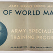


1943 Army Service Forces Manual M-101 Atlas of World Maps
By: Army Specialized Training Division
Date: November 1943 (dated) Washington D.C.
Dimensions: 10.5 x 22 inches (26.7 x 56 cm)
This is a fascinating WWII era atlas of thematic world maps compiled by the Army Specialized Training Program for the study of Geography. As some people are aware, Geography encompasses far more than just maps, including the study of statistical data and how such data translates to the real world in a variety of ways.
The broad subject of Geography is expanded upon throughout this atlas through the thirty maps it contains. As described in the preface, "The maps contained in this Atlas show the natural features of the world, political divisions, and distribution of man, social and cultural institutions, raw materials, industry, and transportation facilities." Each map has its own description, some with statistical tables in the first several pages of the atlas as well as a legend to help understand them.
Condition: This atlas is in B condition with all pages clean and well-attached to the original spiral binding. The atlas was folded for some time (common among these atlases) and does not lay completely flat, but is still quite easy to use.
Inventory #12031
1200 W. 35th Street #425 Chicago, IL 60609 | P: (312) 496 - 3622