


1932 Supervue Map of New York City
By: Samuel Freedman
Date: 1932 (copyright) New York
Dimensions: 18 x 28 inches (45.7 x 71.12 cm)
A rare first edition example of the Supervue Map of New York City, distinguished from later editions by the absence of the iconic Hotel Edison on 47th street, which was built in 1931 in Art Deco style, and for whose opening Thomas Edison himself turned on the marquee lights.
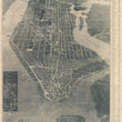
The map covers the entire island, and also includes Ellis Island, the Statue of Liberty, Governors Island, Cortland and Bronx Parks and the Botanical Garden. Parts of New Jersey, Brooklyn and Long Island are featured as well.
An inset in the lower left quadrant features an enlarged view of Central Park. Important architectural edifices are drawn and named and an alphabetized list of streets runs along the border from top to bottom on the right. All bridges of the day are beautifully illustrated, and railways designated. Piers are numbered and named, as are the myriad ferries which serviced (many of which still do service) this busy area. A coded key to the map occupies an area below the image. This comprehensive key lists major points of interest, steamship piers, districts of the city such as Chinatown and Little Italy, and the names of the city’s parks and bridges.
Freedman was a Russian-American printer and publisher who was active in New York City in the first half of the twentieth century. Having immigrated to the US at the age of seven, in 1887, by 1925 he had his own printing shop in the city.
Condition: This vintage pictorial map is in A condition and backed with archival paper and linen for preservation and presentation purposes.
Inventory #11627
1200 W. 35th Street #425 Chicago, IL 60609 | P: (312) 496 - 3622