


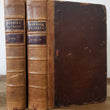


1744 - 48 Harris's Voyages Vol I & II
Navigantium atque Itinerantium Bibliotheca. Or, a complete collection of voyages and travels. Consisting of above six hundred of the most authentic writers ... Now carefully revised, with large additions, and continued down to the present time
By: John Harris
Date: 1744 - 1748 (dated) London
Dimensions: 15.5 x 9.5 inches
This superb example Harris's Voyages, Volumes I & II, complete with 61 maps and prints is a remarkable account of the voyages and discoveries of numerous important explorers of the 16th - 18th centuries. Some such explorations detailed in the two volume work include Purchas, Magellan, Drake, Dampier, the Dutch East India Company, Tasman, Rubruquis, Laval, Roggevien, and Herrera, to name a few.
This example, the second edition of the series (first completed in 1705) is more sought after for the additional maps that were included. One map included in this edition is Tasman's "A Complete Map of the Southern Continent," (Australia) complete with two articles detailing the discovery and description of what was then known as New Holland.
Another map of significance is "A New Map of Georgia, with Part of Carolina, Florida and Louisiana..." which depicts the most up to date information regarding the coastal settlements, Indian villages and their level of hostility to the English, military forts of both the French and English, trading posts and main trails, many of which appear for the first time in any published map.
Condition: Titles printed in red and black, 61 engraved maps, and prints. Slight damage to outside covers includes some chips, scrapes and roughing to corners. Pages are slightly browned with age but very few with any minors tears. Spine in very good condition.
Inventory #11447
1200 W. 35th Street #425 Chicago, IL 60609 | P: (312) 496 - 3622