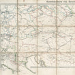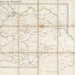


1861 Eisenbahnkarte von Österreich
By: Artaria & Comp.
Date: 1861 (dated) Vienna
Dimensions: 18 x 23 inches (45.7 x 58.5 cm)
A uncommon and attractive railroad map of Austria published out of Vienna in the mid-19th century. Produced as a practical map for travelers, this piece has undoubtedly experienced extensive use while managing to preserve a considerable amount of its original aesthetic charm.
The map is linen backed, folded as issued and still attached to its original hard covers that features an attractive coal powered, steam locomotive on the front. The geographic area presented in the map spans from Lombardy, Switzerland and Bavaria in the west to the Russian Empire and Moldavia in the east. Railroad line cover much of the map and are differentiated in color and design by those that are commonly used, those under construction, and those that are proposed. Additionally, a symbol of two pick axes that reference coal mining operations are scattered about the map. While physical topography such as mountains are omitted, rivers and their tributaries appear throughout the map.
Austria During the 1860s
Austria was part of the Austro-Hungarian Empire, a multi-ethnic and multi-national state that emerged from the Habsburg Monarchy. The empire was a major European power and covered a vast territory in Central and Eastern Europe.
This map was published one year after Emperor Franz Joseph I appointed Count Friedrich Ferdinand von Beust as the Minister of State, who initiated constitutional reforms. In 1866, Austro-Prussian War, also known as the Seven Weeks' War would take place and find Austria on the losing side to Prussia, which would result in the dissolution of the German Confederation, and Prussia emerging as the dominant German power.
Overall, the 1860s were a tumultuous period for Austria, marked by political reforms, military defeat, and the reorganization of the empire in response to the challenges posed by nationalism and changing geopolitical dynamics in Europe.
Condition: Map is in A condition still firmly bound in its original covers. The spine has a 2" separation that has been mended inside. The map shows signs of use with some foxing and occasional markings in orange.
Inventory #12709
1200 W. 35th Street #425 Chicago, IL 60609 | P: (312) 496 - 3622


