


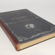


1900 E. Debes' Neuer Handatlas
Neuer Handatlas über alle Teile der Erde in 61 Haupt- und 124 Nebenkarten mit alphabetischem Namenverzeichnis herausgegeben von E. Debes
By: Ernst Debes
Date: 1900 (dated) Leipzig, Germany
Dimensions: 17.75 x 12 x 1.75 inches
This is a very fine example of Ernst Debes world atlas published out of Leipzig, Germany at the turn of the 20th century. At the time, the Debes family was one of the more prominent atlas makers in Germany, producing works such as this with high quality paper and printing techniques representative of the highest standards of German craftsmanship.
The atlas consists of 61 double-page maps that are individually bound into the spine in the same manner as atlases of centuries past. This allows any double-page map to be removed without separating it into two pieces. The atlas covers every continent as include numerous thematic works that focus on climate, religion, transportation, and linguistics.
Some cartographic points of interest include a receding Indian Territory in the growing state of Oklahoma and a lack of cartographic detail in the Amazon as the atlas was printed during a time of ongoing exploration by people like Percy Fawcett and President Teddy Roosevelt.
Condition: This atlas is in B+ condition with some rub damage to the outer edges of the spine and covers. One map (No. 6 Klima) is dis-bound but still present. There is little to no foxing on any of the pages.
Inventory #12017
1200 W. 35th Street #425 Chicago, IL 60609 | P: (312) 496 - 3622