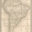

1842 Amerique du Sud
DESCRIPTION
This is a large and attractive map of South America issued folding, dissected into 21 parts, backed with linen and housed in an original slip case.
The map presents South America with extensive detail and original outline color, noting geo-political boundaries, cities, towns, and villages, river systems, and mountain ranges. The various sources used for this map are described in the lower right, between the explanation of colors and the scales of distance. Small inset maps in the lower corners include the Galapagos Islands and the New Shetland or Orcades Islands of the southern Atlantic.
South America in the Mid-19th Century
South America was in a complex and dynamic state at the time of publication, characterized by the aftermath of independence, ongoing political challenges, economic dependencies, social inequalities, and cultural developments. The region was in a state of flux as nations sought to establish their identities and overcome the legacies of colonial rule.
Many countries had gained independence from Spanish rule but were finding their footing as they dealt with internal struggles, such as social inequalities that spanned from the few elite who controlled much of the wealth and power to the Indigenous populations and slaves, which faced marginalization and exploitation. As a whole, the continent was comprised of countries jostling for superiority among one another and foreign interventions were common, with European powers and the United States influencing affairs across the continent.
CONDITION
1200 W. 35th Street #425 Chicago, IL 60609 | P: (312) 496 - 3622


