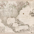


1784 A New and Correct Map of North America with the West India Islands
By: M. Albert & G. F. Lotter
Date: 1784 (dated).
Dimensions: 45.5 x 39.5 inches (115.5 x 100.25 cm).
This is a great example of the rare four sheet map of North America Mexico and the Caribbean by George Frederic Lotter. The map features inserts of Baffin and Hudson's Bay the northern Gulf of California a seven scales of distance table and a decorative cartouche depicting British merchants at a port with a ship in the background being loaded with cargo.
Throughout this map is an immense amount of geographical and historical information including locations of indigenous tribes, expedition routes and discoveries, beaver hunting lands, forts and the dates they were established, unknown tracts of land, false islands in Lake superior, and geographical features once thought to exist deemed imaginary. The top left portion of the map features an inset of northern Canada to the Arctic, showing the extent of geographic knowledge prior to the numerous failed expeditions by the British in search of the Northwest Passage that would be undertaken during the first half of the 19th century. The oceans contain trade wind directions as well as shipping routes from South America and Mexico to Havana and out to Spain.
This is an absolutely stunning map with enough information to keep any history buff occupied for hours on end. A great center piece for any North American historical or cartographic collection.
Condition: Map is in B+ condition with some facsimile work done to the lower portions of the two top sheets. The entire work has been joined and reinforced through professional linen-backing.
Inventory# 18291
1200 W. 35th Street #425 Chicago, IL 60609 | P: (312) 496 - 3622


