

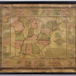

1843 Mitchells' National Map of the American Republic or United States of North America
Mitchells' National Map of the American Republic or United States of North America together with Maps of the Vicinities of Thirty-Two of the Principal Cities and Towns in the Union.
By: Samuel A. Mitchell
Date: 1843 (dated) Philadelphia
Dimensions: 38 x 47 inches (96.5 x 119 cm)
This remarkable piece of cartographic history features the United States as it was in 1843 with a portion of Texas as a Republic, a large Iowa and Indian Territory. Surrounding the primary map are thirty-two small inset maps of what was then considered the most important towns and cities of the union. Such insets do not often appear in most other maps of the United States, some of which include Lexington, Louisville, Nashville, Mobile, Savannah, Buffalo, Indianapolis, Rochester, Springfield, Cincinnati, and St. Louis, to name a few.
The 1840s was a time of revolutions for many European countries, most of which occurred in the latter years of the decade. At the same time, gold would be discovered in California that would spark massive migration to the western that would change the course of history for the United States for years to come. At the time of printing this map, westward expansion was well underway with regards to what was known as the Northwest Territory of what is now, Ohio, Indiana, Michigan, Illinois, Wisconsin, and Minnesota. The primary method of travel and shipping of raw materials was via the Ohio River Valley with which the population expanded outward during the firth half of the 19th century. Thus spawned many of the town and cities listed above and featured in the map.
Many events would soon follow the printing of this map, including the Mexican American War, California Gold Rush, the Civil War, and Trans-Continental Railroad making this map a unique look at the United States right before a time of great change to the nation as a whole.
Condition: This wall map is in B condition with some water staining in the top right and left corners and a few minor areas where the paper has lifted from the linen along the bottom. The map exhibits great original color that has not really faded given its age and is still bound to its original rollers.
The map can be be removed from the rollers for framing purposes at the request of the buyer.
Inventory #11472
1200 W. 35th Street #425 Chicago, IL 60609 | P: (312) 496 - 3622