


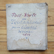
1811 General Charte von Teutschland
DESCRIPTION
By: F. L. Güssefeld
Date: 1811 (published) Weimar
Dimensions: 25 x 32.5 inches (63.5 x 82.6 cm)
This highly detailed folding map of Germany provides much information of all postal roads from Paris to Warsaw, and from Trieste to Stralsund as they were in the early 19th century. According to information on the map, it was designed according to good sources after the Peace of Vienna on October 14th. Güssefeld was a German engineer, surveyor, forester and cartographer whose works were published primarily by the Homann Heirs.
Condition: Map is in C+ condition Engraved map dissected into 24 sections and laid on linen with several annotations and some damp staining within.
Inventory #12603
CONDITION
1200 W. 35th Street #425 Chicago, IL 60609 | P: (312) 496 - 3622