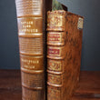


1744 Journal d'un voyage fait par ordre du Roi dans l'Amérique Septentrionnale
By: Pierre Francois Xavier Charlevoix
Date: 1744 (dated) Paris
Dimensions: 6.75 x 4.2 (17 x 10.5 cm)
This is the scarce 5th book of a 6 volume set that describes in great detail the voyages of Charlevoix through the French territories of North America. Charlevoix was commissioned by the French to provide military surveillance of the remaining French holdings in the New World, with hopes of locating a passage to the Pacific that they believed to find through a network of rivers extending west from the Great Lakes. It is through these activities of discovery and exploration that some of the most important maps of the Great Lakes were prepared and numerous place names declared that remain to this day.
The book consist of 456 pages that describe in French text the details of Charlevoix's travels through the Great Lakes region of North America. Five maps accompany the text including "Carte des Lacs du Canada," which is arguably one of the most important maps of the Great Lakes ever created as it is the earliest obtainable map to include the four false islands of Lake Superior; Philippeaux, Pontchartrain, Maurepas, and St. Anne. Charlevoix noted the importance of the islands with regards to their mineral and timber resources. They would appear in many subsequent maps, including John Mitchell's 1755 wall map of America that would be used during the 1783 Treaty of Paris to help distinguish the border between America and British Possessions in Canada. Of course the eventual realization that the islands never did exist would lead to geo-political strife between the two countries later down the road.
Other maps found within this scarce 5th volume include"Carte de l'Ocean Occidental et Partie de l'Amerique Septentrionale," Carte de l'Isle d'Orleans et du Passage de la Traverse dans le Fleuve St. Laurent," Carte du De'troit entre le Lac Superiur et le Lac Huron," and "Plan de Bassin de Quebec et de ses Environs." All of these map were created by Jacques Nicolas Bellin who is considered one of the most important map makers of the 18th century. While he is widely known for an extensive career of over 50 years primarily producing nautical charts of nearly every coastline around the world, it was his maps of the Great Lakes that ultimately held the most historical significance a and altered the course of history for years to come.
Condition: Book is in A condition with a contemporary mottled leather binding, stamped spine, 5 raised bands, leather labels, and marbled end papers. Book comes in a custom case for preservation and presentation purposes. All maps are folded and securely bound within the spine.
Inventory #11474
1200 W. 35th Street #425 Chicago, IL 60609 | P: (312) 496 - 3622


